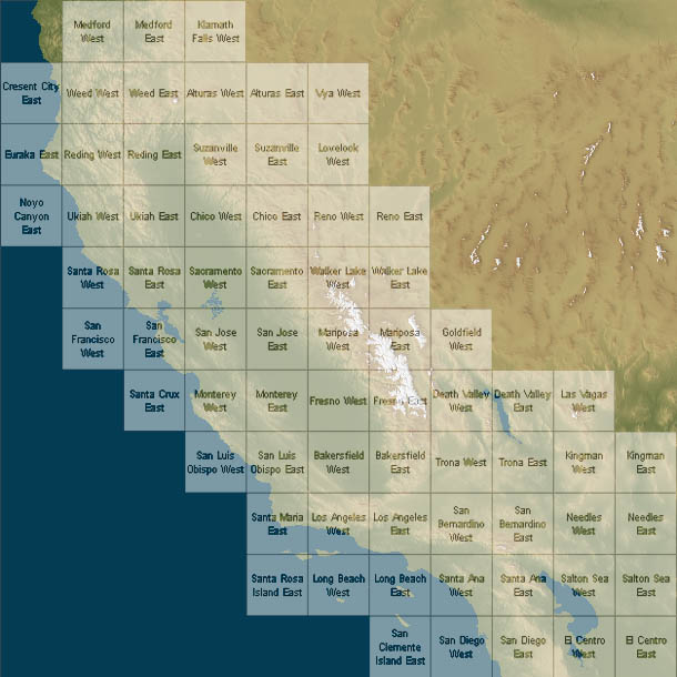
The DEMs listed here are in standard USGS format, They are 10 meter DEMs at a scale of 1:24,000. The files are zipped and are between 1~3 Megabytes in size. Each uncompressed DEM is around 10 megabytes in size.
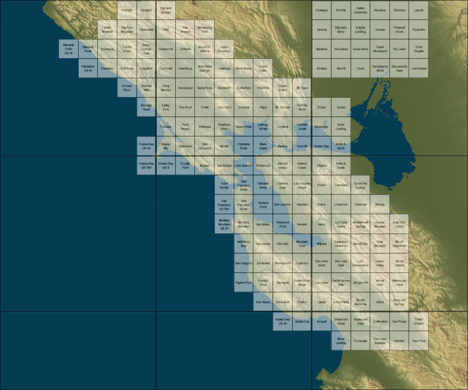
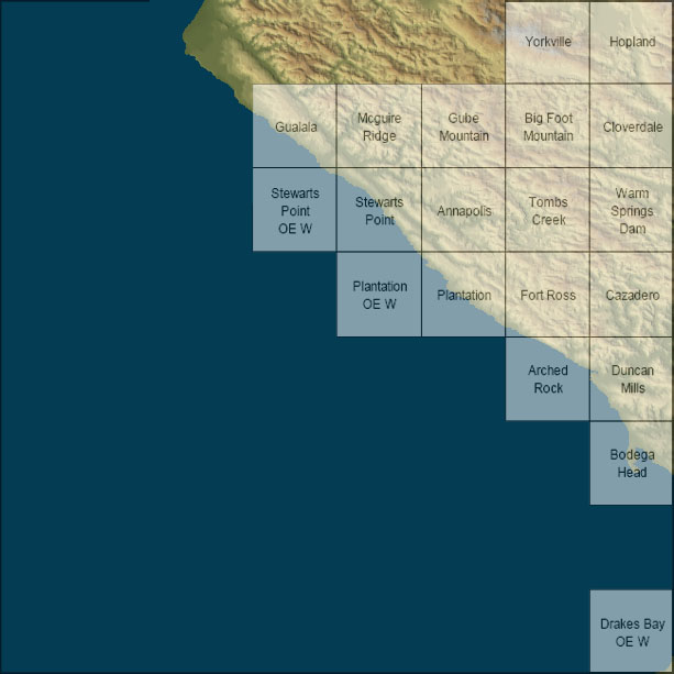
Annapolis
Arched_ Rock
Big Foot Mtn
Bodega Head
Cazadero
Cloverdale
Drakes Bay OE W
Duncan Mills
Fort Ross
Gualala
Gube Mountain
Hopland
McGuire Ridge
Plantation
Plantation OE W
Stewarts Point
Stewarts Point OE W
Tombs Creek
Warm Springs Dam
Yorkville
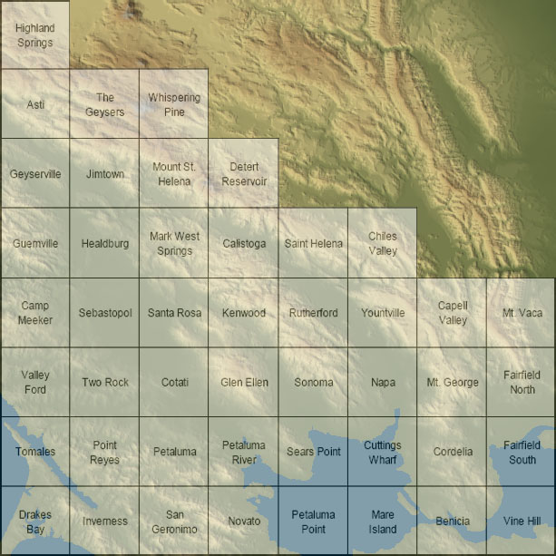
Asti
Benicia
Calistoga
Camp Meeker
Capell Valley
Chiles Valley
Cordelia
Cotati
Cuttings Wharf
Detert Reservoir
Drakes Bay
Fairfield North
Fairfield South
Geyserville
Glen Ellen
Guerneville
Healdsburg
Highland Springs
Inverness
Jimtown
Kenwood
Mare Island
Mark West Springs
Mount St Helena
Mt George
Mt Vaca
Napa
Novato
Petaluma
Petaluma Pt
Petaluma River
Point Reyes
Rutherford
Santa Rosa
San Geronimo
Sears Pt
Sebastopol
Sonoma
St Helena
The Geysers
Tomales
Two Rock
Valley Ford
Vine Hill
Whispering Pines
Yountville
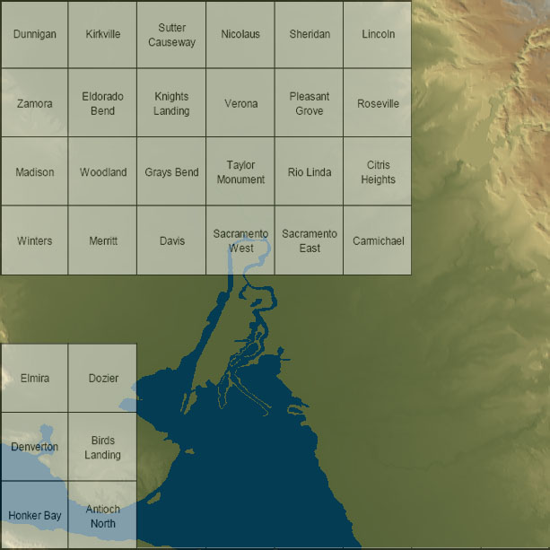
Antioch North
Birds Landing
Carmichael
Citrus Heights
Davis
Denverton
Dozier
Dunnigan
Eldorado Bend
Elmira
Grays Bend
Honker Bay
Kirkville
Knights Landing
Lincoln
Madison
Merritt
Nicolaus
Pleasant Grove
Rio Linda
Roseville
Sacramento East
Sacramento West
Sheridan
Sutter Causeway
Taylor Monument
Verona
Winters
Woodland
Zamora

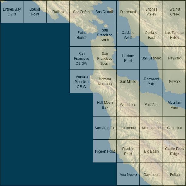
Ano Nuevo
Big Basin
Bolinas
Briones Valley
Castle Rock Ridge
Cupertino
Davenport
Double Pt
Drakes Bay OE S
Felton
Franklin Pt
Half Moon Bay
Hayward
Hunters Pt
Las Trampas Ridge
La Honda
Mindego Hill
Montara Mtn
Montara Mtn OE
Mountain View
Newark
Oakland East
Oakland West
Palo Alto
Pigeon Pt
Pt Bonita
Redwood Pt
Richmond
San Gregorio
San Leandro
San Mateo
San Quentin
San Rafael
San Francisco North
San Francisco South
San Francisco South OE
Walnut Creek
Woodside
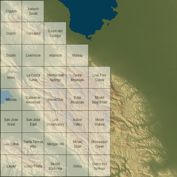
Altamont
Antioch South
Byron Hot Springs
Calaveras Reservoir
Cedar Mountain
Clayton
Diablo
Dublin
Eylar Mountain
Gilroy
Gilroy Hot Springs
Isabel Valley
Laurel
La Costa Valley
Lick Observatory
Livermore
Loma Prieta
Lone Tree Creek
Los Gatos
Mendenhall Springs
Midway
Milpitas
Mississippi Creek
Morgan Hill
Mt Boardman
Mt Day
Mt Madonna
Mt Sizer
Mt Stakes
Niles
Santa Teresa Hills
San Jose East
San Jose West
Tassajara

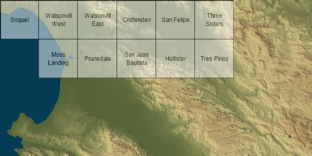
Chittenden
Hollister
Moss Landing
Prunedale
San Felipe
San Juan Bautista
Soquel
Three Sisters
Tres Pinos
Watsonville East
Watsonville West

